
Ushiku-jo (Ushiku city, Ibaraki)|A castle ruin without explanatory signs for its defensive structures—making it quite challenging for beginners to understand
The defensive structures are gradually starting to come into view!
Hello, this is Shin.
On May 29, 2023 (Monday),
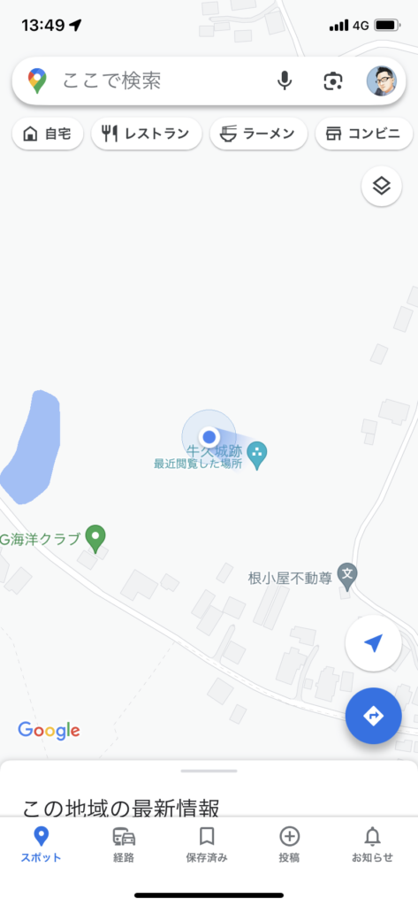
I arrived at Ushiku-jo in Ushiku City, Ibaraki (Hitachi Province), with a light drizzle in the air 🚙
◉ Castle Type
Hilltop castle ( Hirayamajiro:平山城 )
◉ Cultural Heritage Highlights
◉ Defensive Features & Fortifications
◉ Exploration Difficulty
🟡 Moderate Castles
◉ Estimated Time to walk around
: about 1 hour
◉ Parking
There is a small parking area at the municipal Jōnakamachi sightseeing lot,
with space for about 5–6 cars.
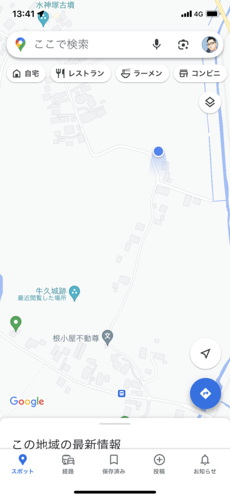
It’s about a 10-minute taxi ride from Ushiku Station on the JR Jōban Line.
I parked my car at the location marked “P” on Google Maps,
( Municipal Former Ushiku Castle site…)
and headed toward Ushiku-jo.
This castle was once ruled by the Okami clan,
and it is said to have stood right between the spheres of influence of the Hojo and Satake clans…
There’s no tenshu or stone walls here,
but even so, a fair number of defensive features remain,
making it quite an impressive hirayama-style(平山城) earthen castle ✊
This is the direction of Ushiku-jo as seen from the parking area.
I’ll rely on Google Maps as I make my way toward the ruins of Ushiku-jo!
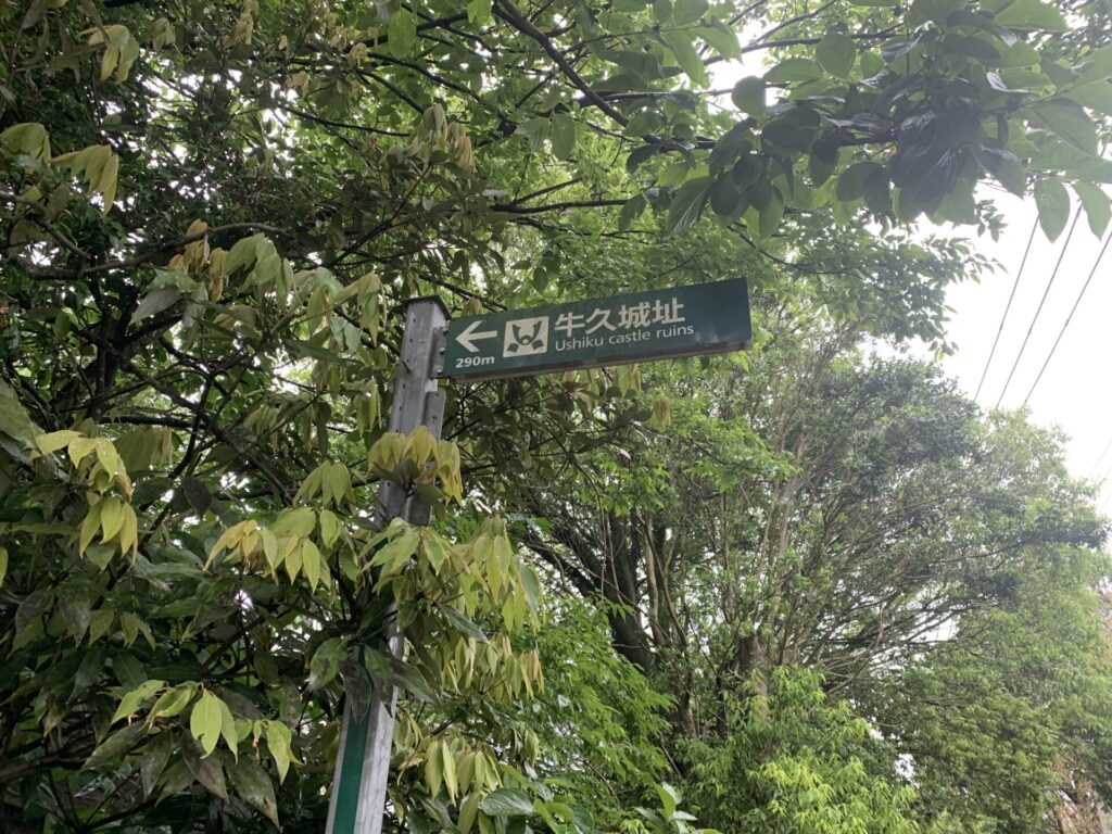
After walking for a few minutes using the map as my guide,
I found it!!
A sign with an arrow pointing to the “Ushiku Castle Ruins”(牛久城址).
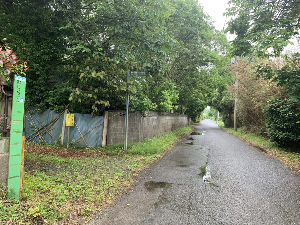
Stepping back a bit, this is what it looks like.
Unless you’re really on the hunt for it,
you might not even notice it… 😅
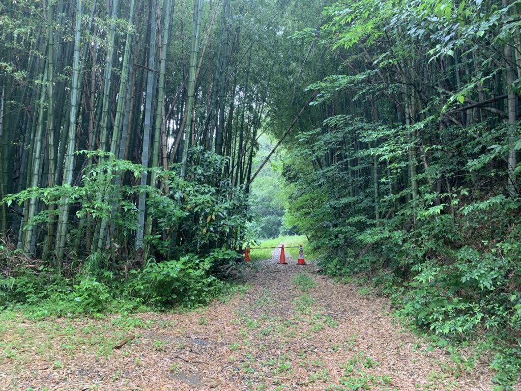
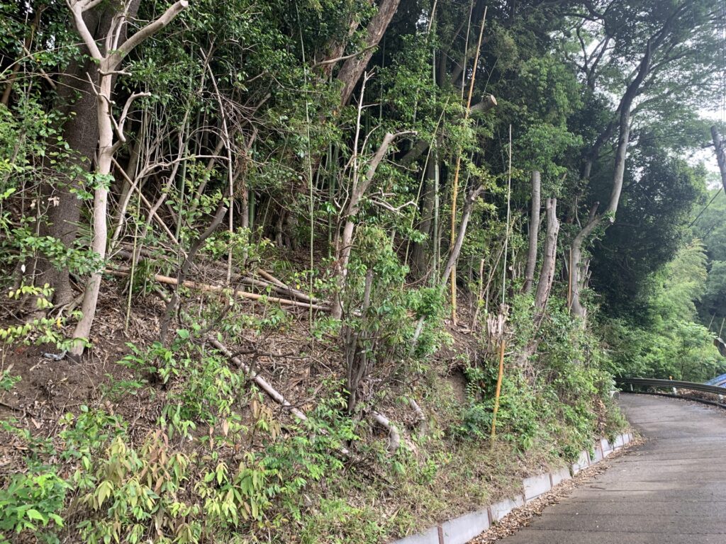
Alright, let’s head further inside.🚶
As expected of a hirayama-style castle,
the path gradually begins to slope upward.
Compared to a full-fledged mountain castle, this is nothing too demanding.
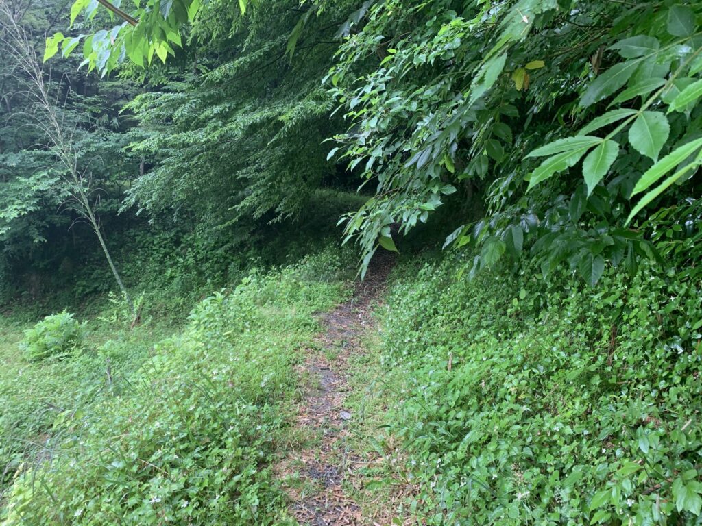
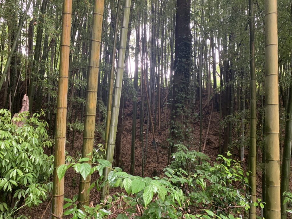
As I made my way deeper into the wooded path, I realized something…
There are no explanatory signs whatsoever at the Ushiku-jo ruins 💦
Even so, I’ve started to recognize things just by reading the terrain—
like, “Ah, this must be an earthen rampart.”
I guess all those visits to earthen mountain castles are finally paying off 😊✨
Now then, please take a look at this video as I continue further along the trail.
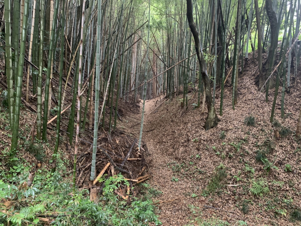
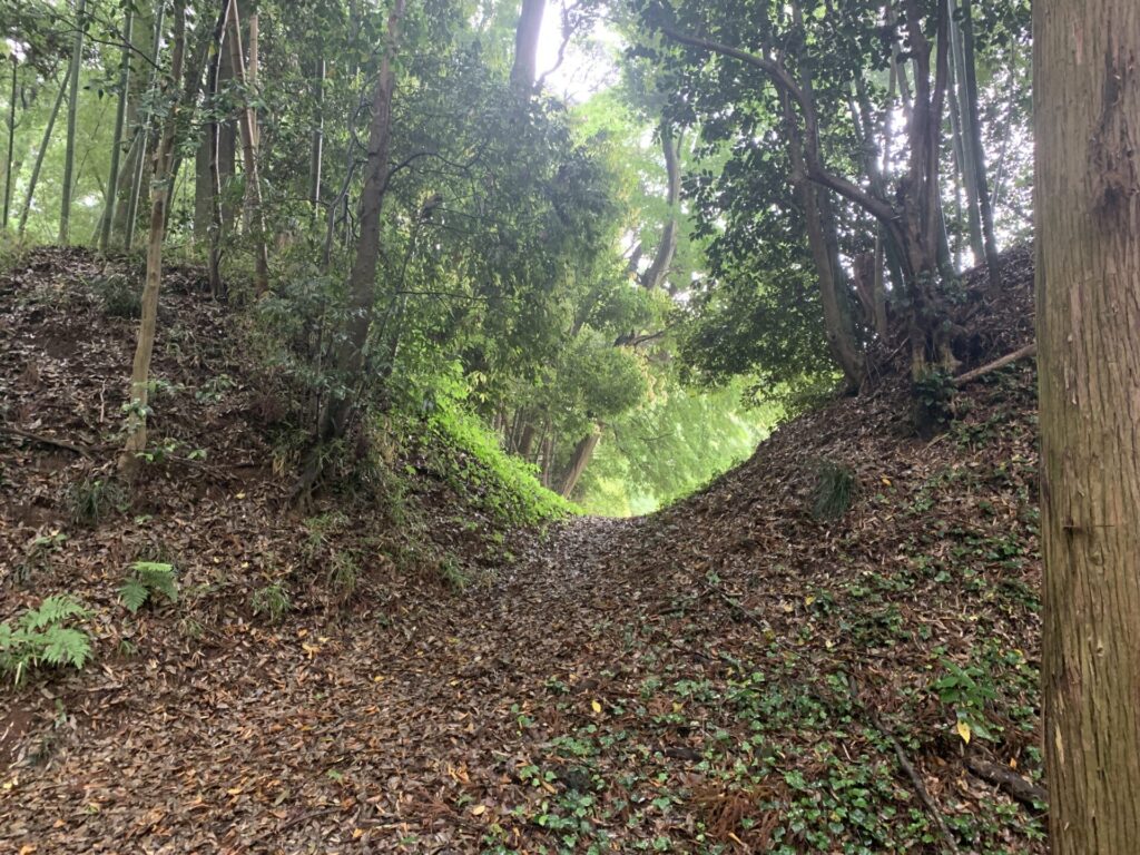
Not only did I spot earthen ramparts,
but despite the thick bamboo grove, I also found a large ditch that is clearly a Karabori(空堀:dry moat)!
Being able to identify these defensive features without any explanatory signs is incredibly fun! 😊
(On the flip side, without that kind of prior knowledge,
you’d probably just see it as nothing more than a “mountain path.”
In that sense, this may not be the best place for beginners to castle exploration…)
I kept pushing forward along a mountain path with not even a single arrow sign to guide the way…
“This has to be a koguchi(虎口)!”
Of course, it’s just my assumption,
but having explored many earthen mountain castles before,
I’m convinced—based on the terrain and the surrounding visibility—
that this is indeed a koguchi(虎口).
A koguchi(虎口)refers to an entrance or exit used by castle troops,
but it was often designed to be narrow, or placed at the top of a slope or beyond a winding path,
in order to prevent enemy forces from easily breaking in.
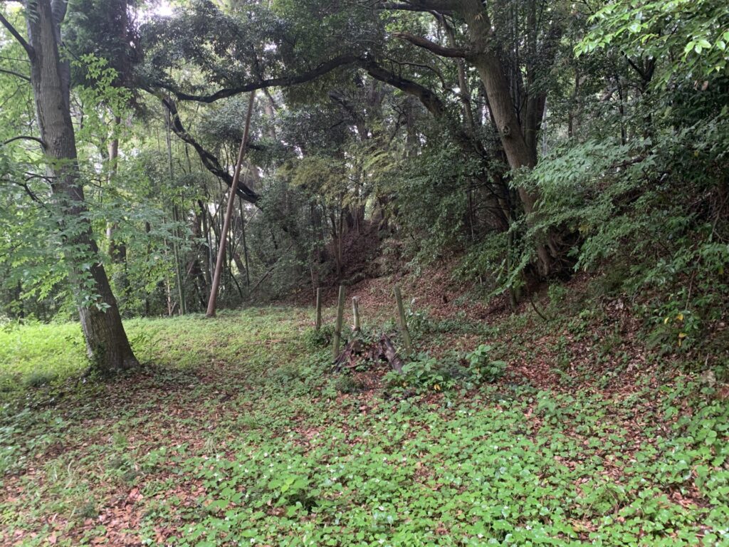
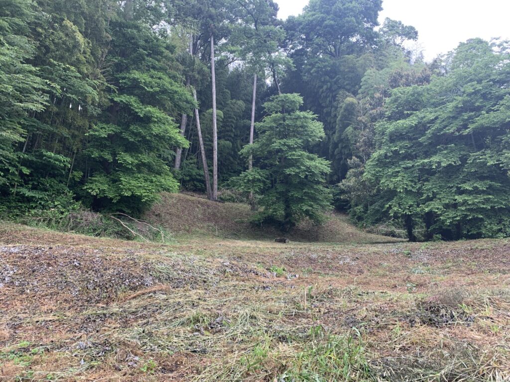
Peeking beyond that koguchi…
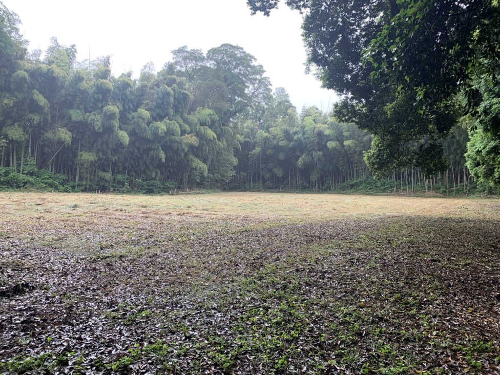
I found a wide, open area.
There are no explanatory signs here either,
but this is likely one of the kuruwa(曲輪)—perhaps even the main enclosure.
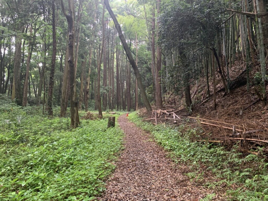
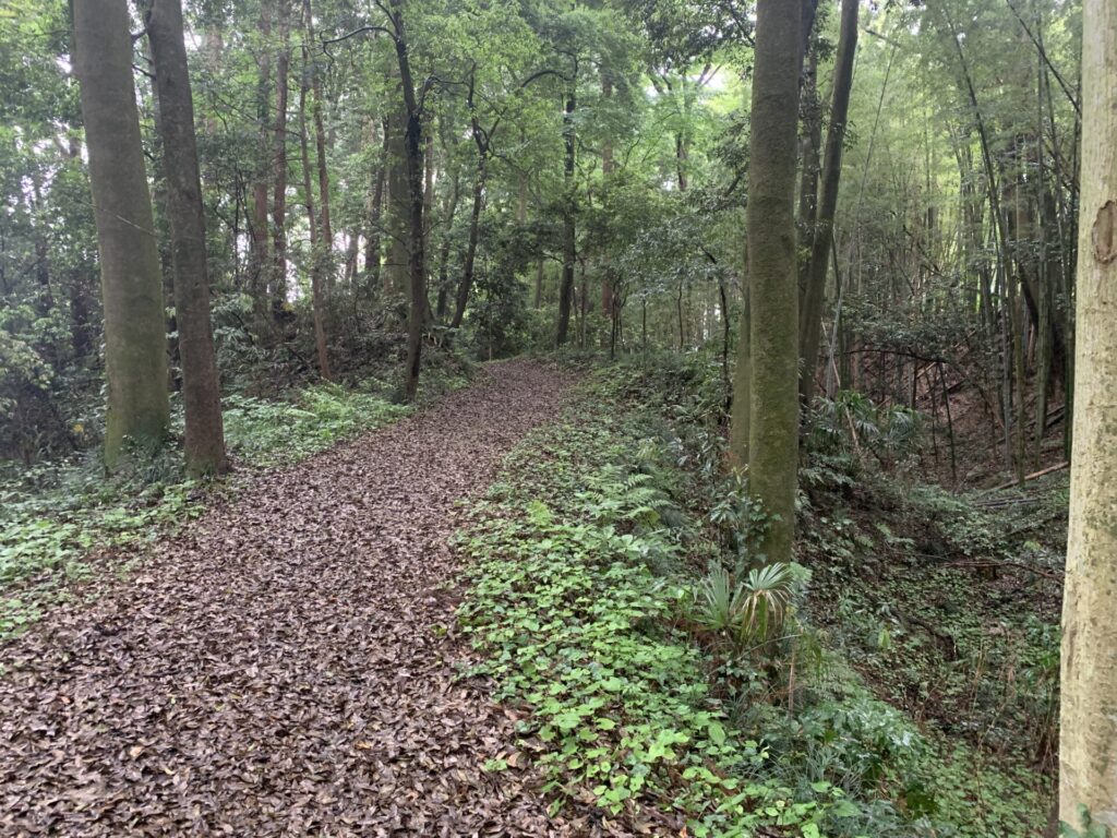
Continuing along the mountain path,
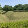
I then came across what appears to be an obi-kuruwa(帯曲輪), so I captured it on video.
Please take a look.
obi-kuruwa(帯曲輪):
It is a flattened space carved into the slope of a hill,
designed to make it easier to intercept enemies advancing from below.
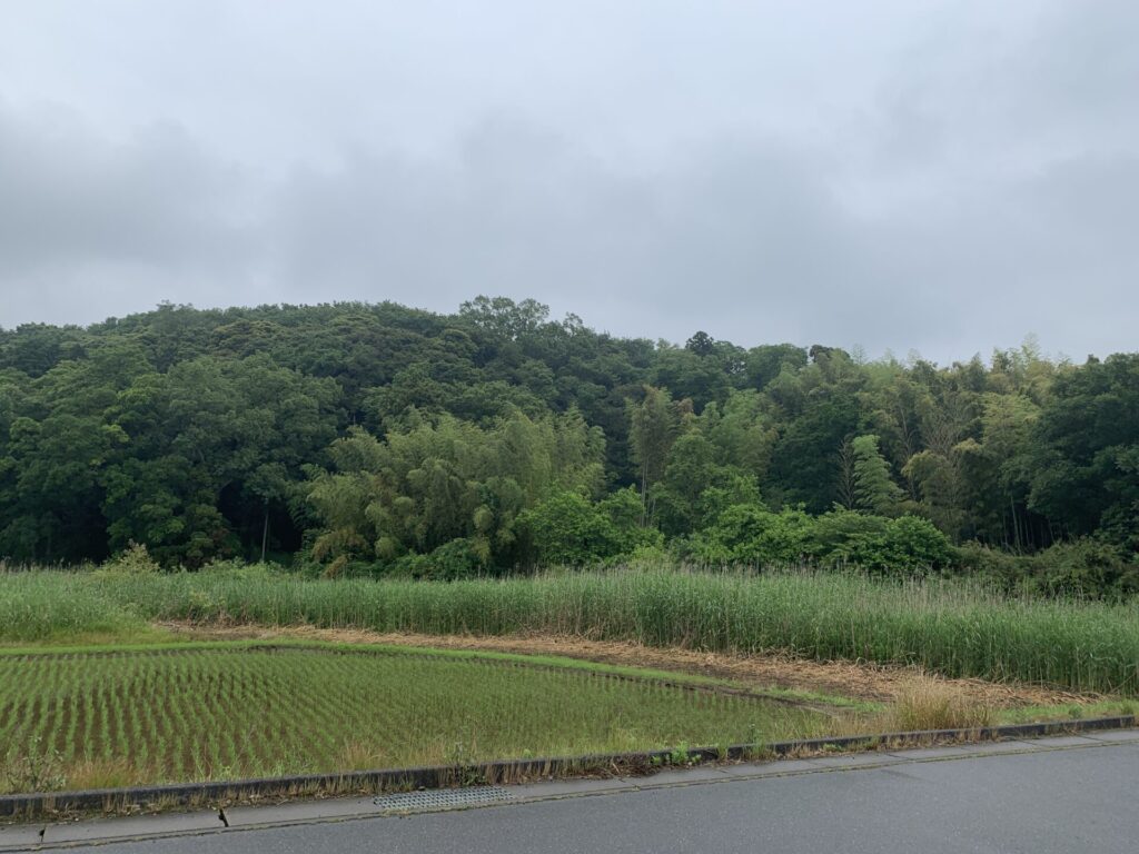
On the right, you can see houses and rice fields.
Those homes and fields sit at a slightly lower elevation than this obi-kuruwa(帯曲輪) (well, that’s my assumption),
while the left side drops off into a steep slope—
making it an ideal position to strike at enemy troops attempting to climb up from below.
Found a layout map of the castle!
Turns out my assumptions were pretty much spot on…
After taking in the obi-kuruwa(帯曲輪) (based on my own assumption),
I continued further along the mountain path.
It may not be very deep,
but you can probably see that the right side forms a moat.
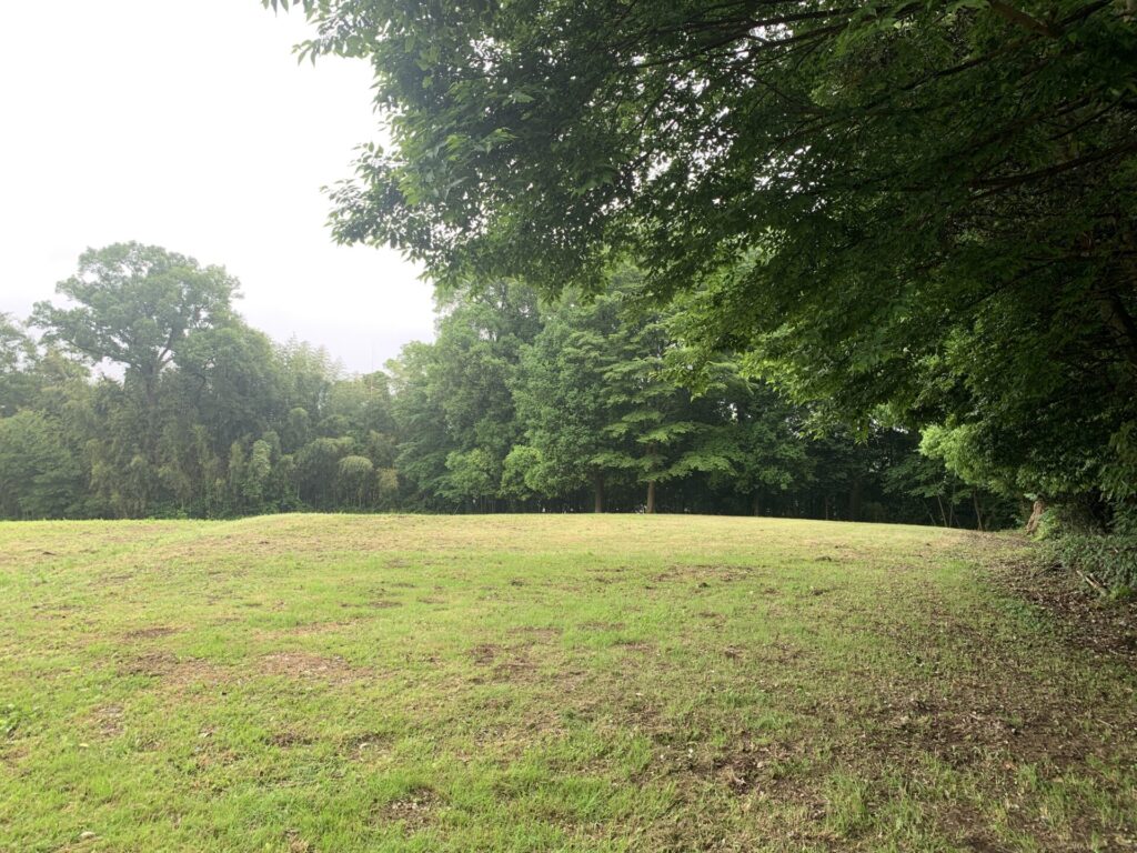
At the end of the path, I arrived at…
a very open, spacious area!!
If we assume that the somewhat large area I came across earlier was the main enclosure,
then this is probably another kuruwa.
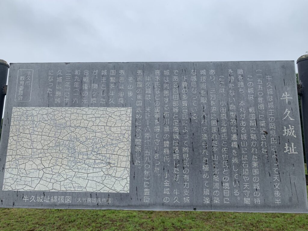
At last, I finally found something that looks like an explanatory sign!!
It’s a bit hard to read, but it seems the castle incorporates construction techniques from the Hojo school…
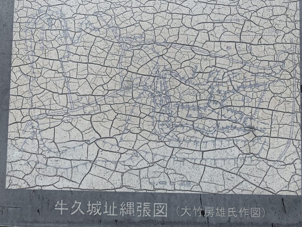
At the bottom left of the sign, there is a layout map of Ushiku-jo.
Once again, the text is quite faded and difficult to read—
(in this photo, you can barely make it out at all… 😓)
It’s almost unreadable,
but after zooming in on the photo,
I could make out the labels Sannomaru(三の丸:third enclosure), Ninomaru(二の丸:second enclosure), and Honmaru(本丸:main enclosure),
arranged from the upper left to the lower right near the center of the map.
That would suggest that the place I’ve just reached is likely the Sannomaru(三の丸:third enclosure).
Also, beneath the Ninomaru(二の丸:second enclosure), there appears to be a label reading koshiguruwa(腰曲輪), stretching along its lower side.
This is almost certainly the spot I had assumed to be an obi-kuruwa(帯曲輪).
In other words, the flattened area carved into the hillside was not an obi-kuruwa,
but a koshiguruwa.
So, what exactly are obi-kuruwa(帯曲輪) and koshiguruwa(腰曲輪)?
Rather than explaining it again here,
it might be easier to understand by looking at an excerpted diagram from a book by castle historian Fusao Nishimata.
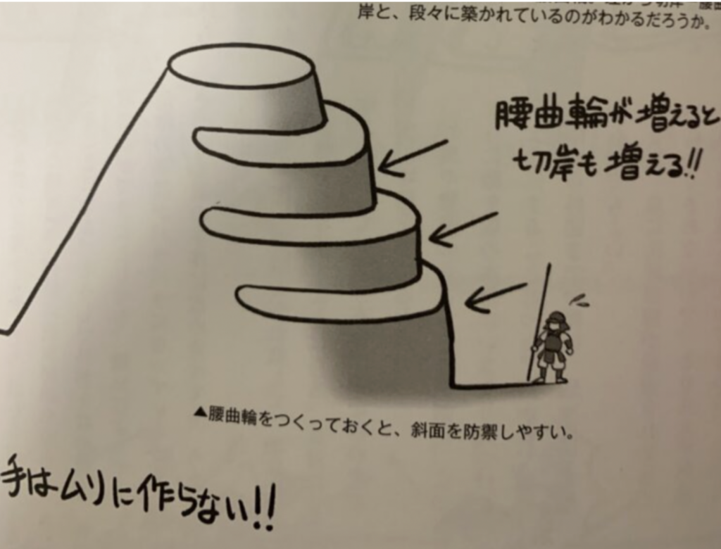
As shown in the diagram above,
by carving out a flat terrace (koshiguruwa(腰曲輪)) along the mountainside,
it becomes much easier to attack enemy troops climbing up from below.
What I initially assumed to be an obi-kuruwa(帯曲輪)actually refers to a much longer terrace that wraps around the mountainside.
So my earlier judgment calling it an obi-kuruwa(帯曲輪) was simply a rookie mistake 💧😓
If you’re looking for a castle ruin where you can clearly see a classic obi-kuruwa(帯曲輪),
then Sakura-jo (Shimofusa Province, Chiba) is probably the best example—for now.
What is a “Nekoya”?
Now that I’ve checked the layout map of Ushiku-jo and have a general idea of its structure,
it’s time to go look for the Honmaru(本丸:main enclosure), which I probably haven’t explored yet ✊
After all, the Honmaru(本丸:main enclosure) should be located in the deepest part of the mountain, where it’s hardest for enemy forces to reach—
so I must have missed a side path somewhere along the way.
But before that…
Taking another look at Google Maps,
I noticed a place called Nekoya Fudōson(根小屋不動尊) near the Ushiku-jo ruins.
The term nekoya is something you often see around many castle sites.
It refers to an area at the foot of a mountain castle where soldiers would stay—
serving as a lookout and a kind of forward base.
Originally, it’s said to have come from the word “nekoya(寝小屋)” (sleeping huts),
which gradually evolved into place names like Nekoya(根小屋) or Nekoya(根古屋) over time.
So when you visit castle ruins—especially mountain or hirayama-style castles—
it might be worth checking whether this name appears in the surrounding area.
Well then, let’s first try to find this Nekoya Fudōson(根小屋不動尊).
From the Sannomaru(三の丸:third enclosure) I just visited,
I made my way out onto a regular road and started heading downhill.
As I walked along the road, something caught my eye—
I spotted what looks like another earthen rampart further ahead.
I’ll check that out later too.
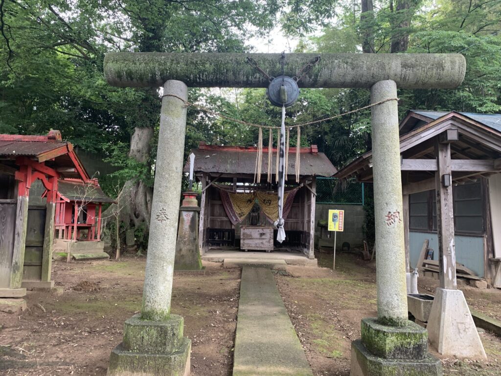
Found it!!
This must be Nekoya Fudōson(根小屋不動尊).
This area was likely where the castle soldiers once stayed and slept.
Now then, let’s take a closer look at that rampart-like feature I noticed earlier—
I’ve captured it on video, so please take a look.
This spot is located just a short distance from Nekoya Fudōson(根小屋不動尊).
Climbing up onto what appears to be an earthen rampart and pushing further inside…
it connected to that narrow path through the bamboo grove I found earlier!
This was likely another entrance or exit as well.
Time to find the Honmaru!!
Now, it’s finally time to go and search for the Honmaru(本丸:main enclosure).
I retraced my steps along the mountain path,
and made my way back near the Ushiku-jo marker on Google Maps.
Ah—could this be it?!
Beyond the bamboo grove, I can see what looks like an open area I haven’t explored yet…
Come to think of it, there was a side path around here just off the slope I first climbed—
and I haven’t checked it out yet.
Let’s take a look at this spot in the video.
This path also has moderately deep moats on both sides,
and the approach to the honmaru bends sharply—
there’s no doubt this is a koguchi(虎口:defensive gate).
And at last, I was able to confirm the Honmaru(本丸:main enclosure)!
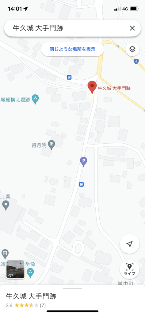
Finally, I’ll head over to the site of the Ōtemon(大手門)—located a bit away from the Ushiku-jo ruins—before calling it a day.
Following Google Maps, I drove a short distance and found it not too far away.
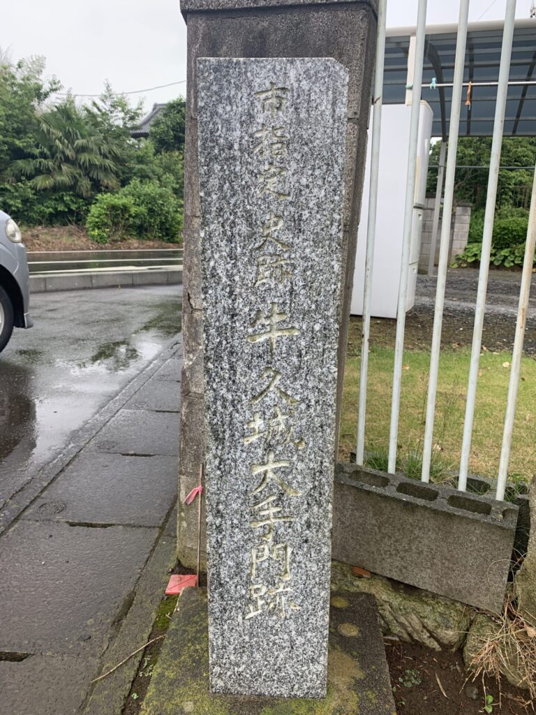
The text is quite faded here as well, but it reads “Site of Ushiku-jo Ōtemon(牛久城大手門跡)”.
As is often the case when visiting castle ruins,
places labeled “~ Gate Site” are usually already surrounded by modern buildings.
This one, too, had become part of a residential area.
With that, I conclude my exploration of Ushiku-jo.
See you again in the next article!🏯